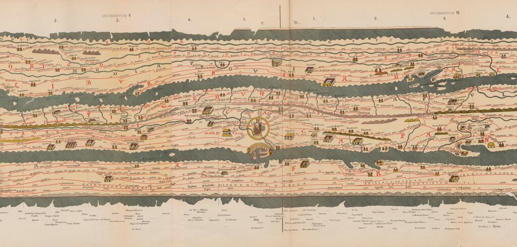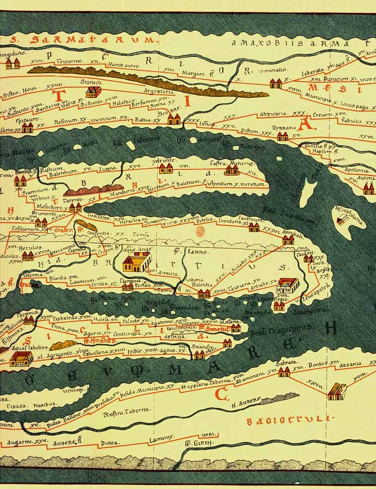
The Peutinger Table, named after the 16th-century humanist Konrad Peutinger, who owned the sole surviving copy, is a medieval map believed to be a copy of an earlier Roman original. Stretching from the British Isles to the Indian subcontinent, this remarkable cartographic masterpiece charts the expanse of the Roman Empire and its extensive network of roads and settlements.
The origins of the Peutinger Table can be traced back to the late Roman period, circa the 4th or 5th century AD. While the exact circumstances surrounding its creation remain shrouded in mystery, scholars believe it was derived from earlier Roman itineraries and maps used for military and administrative purposes.
Cartographic Features: Deciphering the Map
The Peutinger Table is characterized by its distinctive elongated format, resembling a modern road map. Divided into twelve sections or “sheets,” the map unfolds to reveal a detailed depiction of the Roman road network, including major cities, towns, and landmarks. Each segment presents a different region of the empire, meticulously annotated with distances and geographic features.
At the heart of the Peutinger Table lies its practical utility as a navigational aid for travelers traversing the Roman Empire. By providing a comprehensive overview of roadways and destinations, the map facilitated efficient communication and logistical planning, enabling the Roman military, officials, and merchants to navigate vast distances with relative ease.
While the Peutinger Table eschews traditional geographic conventions such as scale and orientation, it employs a symbolic language to convey spatial relationships and landmarks. Cities are represented as stylized icons, while roads are depicted as straight lines of varying thickness, denoting their importance and condition.

Scholarly Interpretations: Debates and Discoveries
Despite centuries of study, the Peutinger Table continues to elude definitive interpretation, giving rise to a myriad of scholarly debates and theories. Some scholars argue that it served primarily as a symbolic representation of the Roman Empire’s reach and power, while others contend that it was a practical tool for military logistics and administration.
While the original purpose of the Peutinger Table may remain elusive, its legacy endures as a testament to the ingenuity and sophistication of ancient cartography. Scholars and historians continue to study its intricacies, drawing insights into the political, cultural, and economic landscape of the Roman world.
Interpreting the Peutinger Table poses numerous challenges due to its fragmentary nature and lack of accompanying textual evidence. Attempts to reconstruct missing segments and decipher obscure place names have sparked controversy among scholars, highlighting the inherent limitations of historical cartography.
Conclusion: Charting a Course Through History
As we unravel the mysteries of the Peutinger Table, we embark on a journey through time and space, tracing the footsteps of ancient travelers and explorers. Though the map may remain an enigma in many respects, its enduring significance lies in its ability to illuminate the past and inspire curiosity about the world we inhabit. In our quest to decipher its secrets, we gain a deeper appreciation for the art and science of cartography and the enduring legacy of the Roman Empire.
POPULAR TODAY
They observed the creature from a distance, noting its slow, deliberate movements and its apparent comfort both on land and in water.
