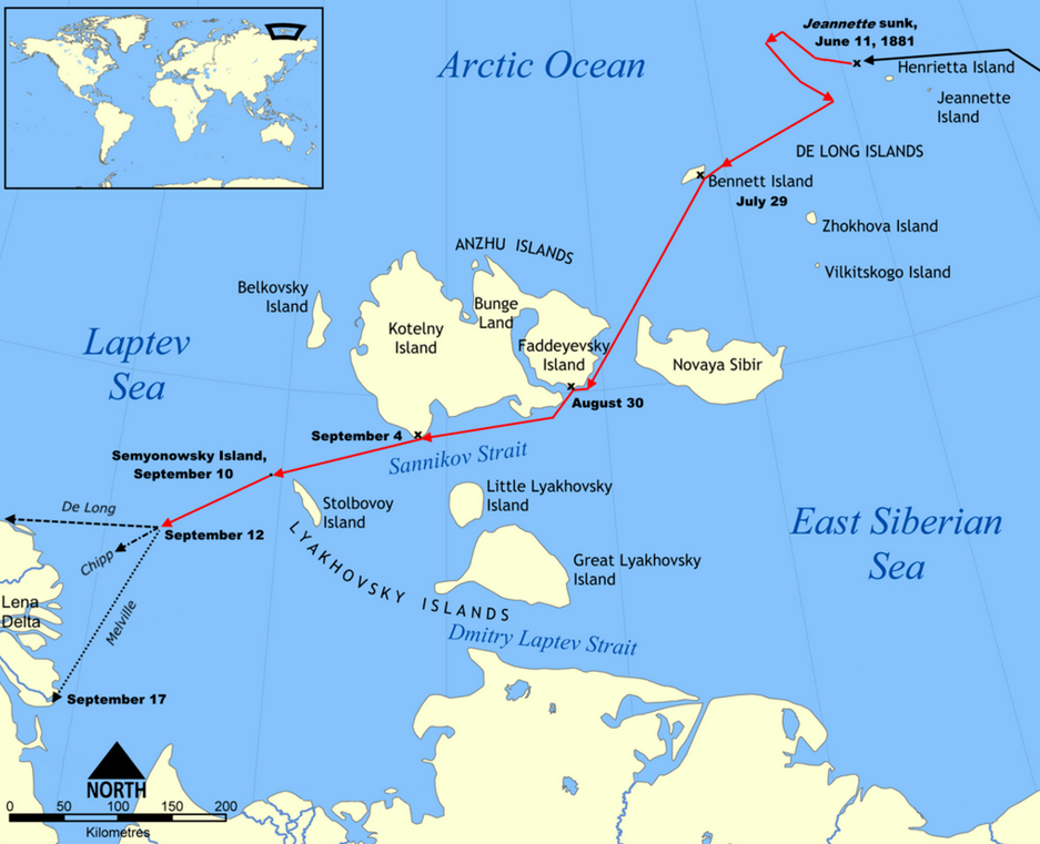
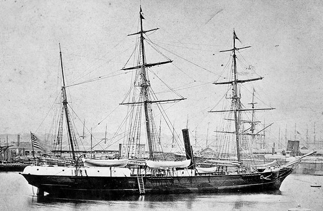
In the late 19th century, the quest to chart the unknown regions of the Arctic was fraught with peril and mystery. Among the many expeditions that ventured into these icy frontiers, the journey of the USS Jeannette stands out due to its combination of ambition, tragedy, and groundbreaking navigation techniques. Captained by Lieutenant Commander George W. De Long, the USS Jeannette set sail in 1879, aiming to reach the North Pole by traversing the uncharted waters of the Arctic. This article delves into the navigation techniques employed by the crew, which proved crucial as they navigated the treacherous, ice-laden seas.
Setting Sail with Innovation
The late 1800s was a period of significant advancement in navigational technology, and the USS Jeannette was equipped with some of the most advanced instruments of its time. The crew relied heavily on celestial navigation, using sextants to measure the angles between celestial bodies and the horizon. This age-old technique allowed them to determine their latitude and estimate their position on the globe.

The Role of Nautical Charts and Compasses
Despite the innovation, nautical charts specific to the Arctic were rudimentary and often inaccurate. The Jeannette’s crew had to constantly interpret and update their charts based on their observations, a painstaking process in the unstable and shifting ice environment.
Magnetic compasses, a staple of navigation, presented a particular challenge in the Arctic. The proximity to the magnetic North Pole caused erratic readings, forcing navigators to rely on celestial navigation more heavily. To mitigate some of these issues, the crew also used a gyrocompass, which helped maintain accurate headings unaffected by magnetic anomalies.
Dead Reckoning
In conditions where visibility was poor and celestial navigation was impossible, the crew resorted to dead reckoning. This technique involved calculating their current position by using a previously determined position, and accounting for known speeds, time elapsed, and courses steered. While not as accurate as other methods, dead reckoning was necessary to make educated guesses about their location when other data was unavailable.
Innovative Use of Soundings
The depth of the ocean floor, or soundings, was another essential tool in the Jeannette’s navigation arsenal. By regularly taking soundings, the crew could identify underwater features and ascertain their relative position. This was particularly useful near coastlines and in the labyrinthine paths through ice floes. The Jeannette was equipped with lead lines and, notably, an early version of an echo sounder, which provided more precise readings and helped the crew make better-informed navigational decisions.

Dealing with the Ice
The ever-present and unpredictable ice floes presented one of the greatest challenges to the Jeannette’s navigators. Ice charts did not exist, so the crew had to rely on visual observations, noting the type and density of ice and plotting courses that offered the least resistance. This required constant vigilance and rapid decision-making, as pathways could close or open with little warning.
To assist with this, the ship’s logbook became an invaluable resource. By meticulously recording observations about ice conditions, weather, and navigational data, the crew built an understanding that would help guide their decisions. This information was not only crucial for their immediate survival but also contributed to the body of knowledge about Arctic navigation and conditions.
Conclusion: Legacy of the USS Jeannette
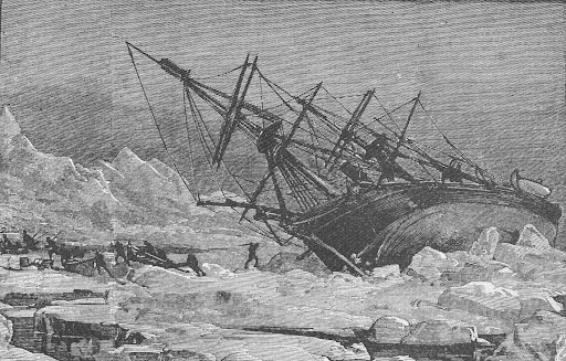
The USS Jeannette’s voyage came to a tragic end in 1881 when the ship became trapped and eventually crushed by ice. However, the expedition’s legacy lives on through the detailed records and data collected by its crew. The navigation techniques they employed—combining traditional methods with innovative tools—paved the way for future Arctic explorers.
The ordeal of the USS Jeannette underscored the harsh reality of Arctic exploration, but it also highlighted the resilience and ingenuity of its crew. Their contributions not only advanced the field of navigation but also expanded our understanding of one of the planet’s most formidable environments.
POPULAR TODAY
In the heart of the Great Plains during the 1930s, a perfect storm of ecological mismanagement, severe drought, and relentless winds coalesced to create one of the most harrowing environmental disasters in American history

